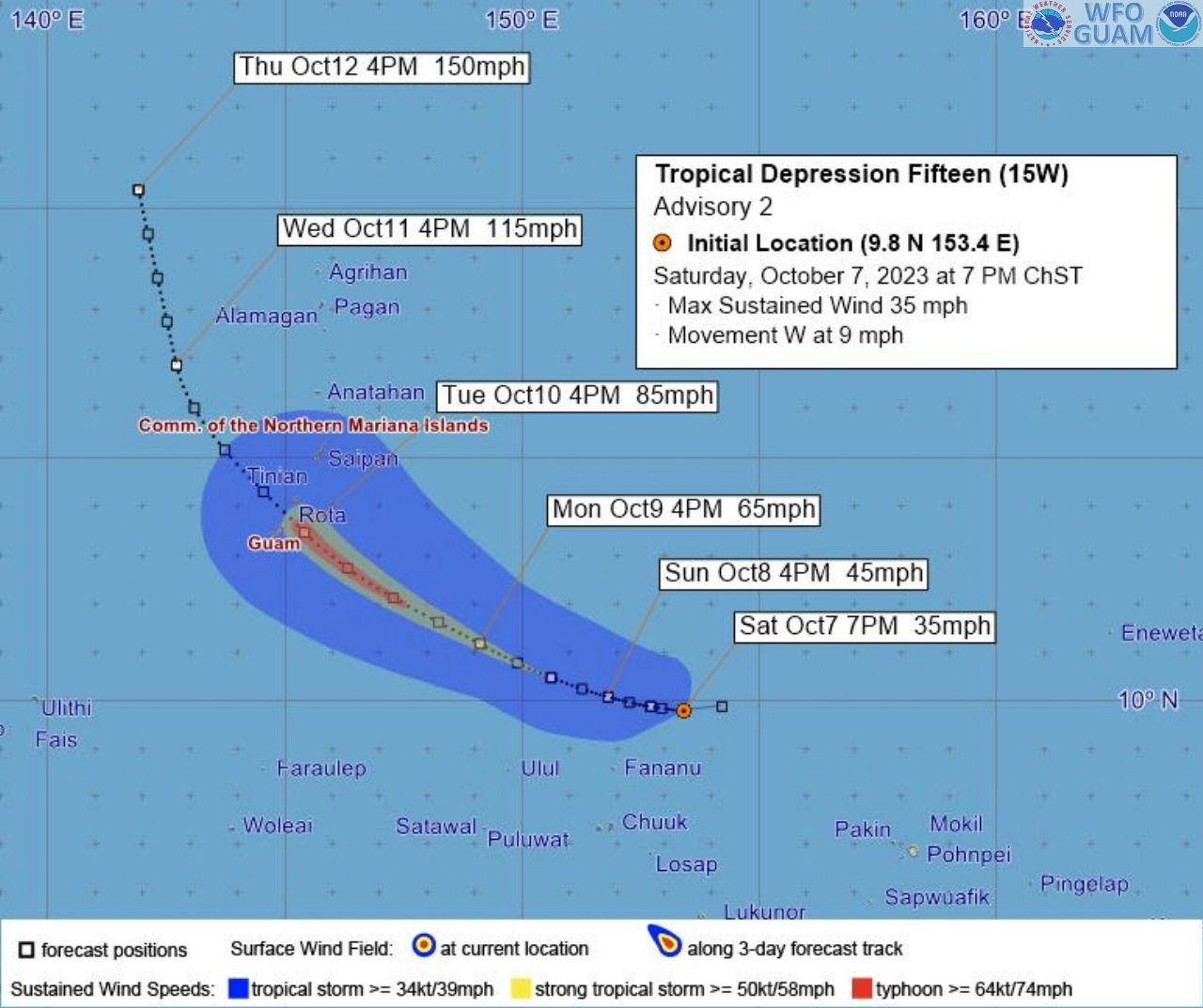
The National Weather Service (NWS) Guam Weather Forecast Office continues to monitor what is now Tropical Storm Bolaven, formerly known as Tropical Depression 15W, as it becomes better organized.
As of 1 a.m., Tropical Storm Bolaven was located near 9.8 degrees north latitude and 153.0 degrees east longitude, about 610 miles east-southeast of Guam, moving west at 6 mph, with maximum sustained winds of 40 mph. Bolaven is forecast to intensify through Monday, possibly becoming a typhoon by Monday afternoon.
What to Expect
Current forecast tracks have Bolaven passing through the Marianas Tuesday night or early Wednesday. The latest forecasts show 6 to 10 inches of rainfall are likely, with locally higher amounts near 12 inches possible.
There is a high possibility for damaging winds of 39 mph or more and/or destructive winds of 58 mph, and heavy rains, to arrive as early as Tuesday morning. Waves may increase, possibly exceeding 15 feet, as fresh to strong sustained winds potentially develop.
There remains uncertainty for the exact track of the system as it approaches the Marianas. Any one, or several islands, may take a near miss or a direct hit next week.
Prepare Now
Residents and visitors are advised to take the following precautionary actions:
-
Those living in flood-prone areas should take action now; clear drainage areas and unblock storm drains to minimize flooding;
-
Stay up to date with the latest information;
-
Clear loose debris around your yard and store any items that may become airborne with heavy winds, such as canopies, tarps, and trampolines, before inclement weather arrives;
-
Have an emergency kit prepared: Store enough food and water for your household for 7-10 days. Include medication, disinfectant supplies and pet supplies;
-
Secure important documents such as birth certificates, tax papers, and insurance documents and keep copies in a water-proof bag;
-
Review your emergency plan: If you do not have a plan, learn how to create an emergency plan; Have plans for your family members and pets. If you are a person with disabilities or a caregiver for elderly, you may need to take extra steps to plan for those additional needs.
-
Get emergency alerts: Stay informed by having a weather alert radio, battery-operated, or hand-crank radio, where you can listen to emergency news;
-
Gas your vehicles and get fuel for your generators;
-
Pull cash from the ATM in case of power outages;
-
Don’t drive through flood waters: Almost half of all flash flood deaths happen in vehicles. When in your car, look out for flooding in low-lying areas at bridges and at highway dips. As little as 6 inches of water may cause you to lose control of your vehicle.
Visit the following links for the latest information:
-
NWS Website: https://www.weather.gov/gum/
-
NWS Facebook: https://www.facebook.com/
NWSGuam/ -
GHS/OCD Website: https://ghs.guam.gov/
-
GHS/OCD Facebook: https://www.facebook.com/
GHSOCD/ -
National Hurricane Preparedness | National Oceanic and Atmospheric Administration (noaa.gov)
> Forecast Track OCT07 7PM


